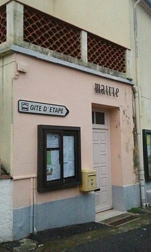
Las Illas

Las Illas (in Catalan: Les Illes) is a former commune in Pyrénées-Orientales (France), now part of Maureillas-las-Illas.
Geography
[edit]Las Illas is located south of Maureillas and north of Maçanet de Cabrenys (Catalonia, Spain).
History
[edit]Las Illas became a commune in 1790.
Las Illas was only linked to the electricity network on 26 July 1955. The commune had repeatedly asked to have electricity since 1923.[1]
On 20 June 1972, Las Illas was linked with Maureillas and Riunoguès to create the new commune of Maureillas-las-Illas.[2]
Politics and administration
[edit]
Mayors
[edit]| Mayor | Term start | Term end |
|---|---|---|
| François Dabouzi[3] | 1945 | 1947 |
| Antoine Auriol[3] | 1947 | 1952 |
| François Dabouzi[3] | 1952 | 1953 |
| Marguerite Dabouzi | March 1965 | June 1965 |
| René Guidicelli | 1965? | ? |
| Raymond Commenge | ? | 1972 |
Demography
[edit]Demography of Las Illas.[2]
Population under the Ancien Régime is calculated either in number of feu fiscal (f, fire tax), or in number of inhabitants.
| 1365 f | 1378 f | 1470 f | 1515 f | 1553 f | 1720 f | 1730 f | 1755 f | 1767 | 1774 | 1789 f | 1794 | 1795 | 1796 |
|---|---|---|---|---|---|---|---|---|---|---|---|---|---|
| 14 | 12 | 4 | 4 | 3 | 5 | 7 | 20 | 110 | 84 | 24 | 91 | 101 | 104 |
| 1800 | 1804 | 1806 | 1820 | 1826 | 1831 | 1836 | 1841 | 1846 | 1851 | 1856 | 1861 | 1866 | 1872 | 1876 | 1881 |
|---|---|---|---|---|---|---|---|---|---|---|---|---|---|---|---|
| 131 | 122 | 129 | 205 | 236 | 269 | 249 | 233 | 281 | 289 | 305 | 280 | 264 | 314 | 237 | 237 |
| 1886 | 1891 | 1896 | 1901 | 1906 | 1911 | 1921 | 1926 | 1931 | 1936 | 1946 | 1954 | 1962 | 1968 |
|---|---|---|---|---|---|---|---|---|---|---|---|---|---|
| 228 | 198 | 181 | 191 | 209 | 192 | 119 | 119 | 85 | 84 | 119 | 67 | 57 | 60 |
After 1975, see Maureillas-las-Illas#Population
Sites of interest
[edit]- The romanesque church of Notre-Dame du Remède.
- The war memorial.
-
The church
-
The war memorial
See also
[edit]Notes
[edit]- ^ Cárdenas, Fabricio (2014). 66 petites histoires du Pays Catalan [66 Little Stories of Catalan Country] (in French). Perpignan: Ultima Necat. ISBN 978-2-36771-006-8. OCLC 893847466.
- ^ a b Jean-Pierre Pélissier, Paroisses et communes de France : dictionnaire d'histoire administrative et démographique, vol. 66 : Pyrénées-Orientales, Paris, CNRS, 1986, 378 p. (ISBN 2-222-03821-9)
- ^ a b c André Balent, Dabouzi, François, Dictionnaire Maitron
42°25′33″N 2°47′06″E / 42.42583°N 2.78500°E


